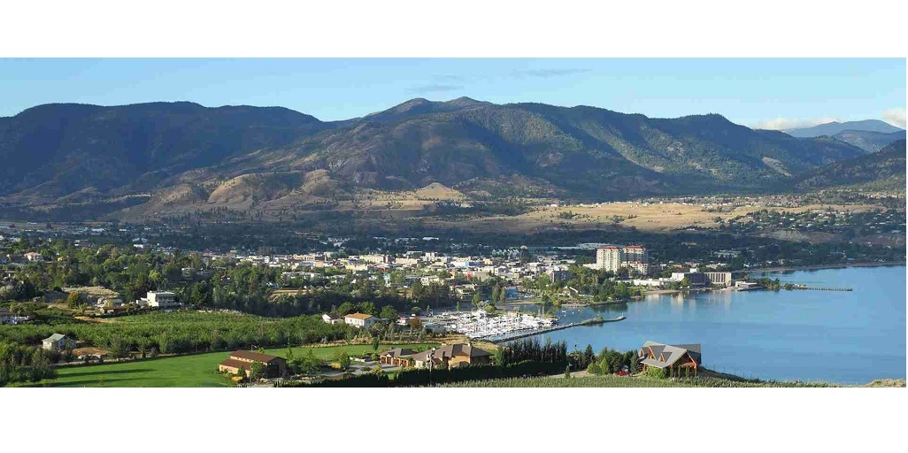
In the picturesque landscape of West Kelowna, sustainable development practices play a pivotal role in preserving the natural beauty and ensuring a thriving community. At the heart of these endeavors lies the often-overlooked hero – land surveying.
In this blog, we’ll delve into the crucial role that land surveyors play in steering the course of sustainable development in West Kelowna.
Understanding Land Surveying
Land surveying is more than just mapping out plots and boundaries; it’s a sophisticated process that involves measuring and mapping the land’s topography, natural features, and human-made structures. In the context of sustainable development, accurate land surveying becomes the foundation upon which informed decisions are made.
Preserving Natural Resources
One of the primary objectives of sustainable development is the responsible use and preservation of natural resources. Land surveyors in West Kelowna employ advanced technologies to assess the land’s natural features, identifying ecologically sensitive areas, water bodies, and wildlife habitats. By precisely mapping these elements, developers can plan projects that avoid disturbing vital ecosystems, promoting harmony between human activities and the environment.
Effective Land Use Planning
Sustainable development hinges on strategic land use planning, and this is where land surveyors shine. They provide essential data that aids planners and developers in allocating space for residential, commercial, and recreational purposes. Through precise measurements and mapping, land surveyors assist in optimizing land utilization, minimizing urban sprawl, and fostering compact, sustainable communities.
Mitigating Risks and Ensuring Safety
In a region like West Kelowna, prone to seismic activities and other natural hazards, the role of land surveyors extends to risk assessment and mitigation. By accurately mapping geological features and potential risks, surveyors contribute to the creation of safer building codes and infrastructure development guidelines. This proactive approach ensures that structures are resilient and able to withstand the challenges posed by the local environment, ultimately safeguarding lives and investments.
Water Management and Conservation
West Kelowna’s proximity to the stunning Okanagan Lake makes water management a critical aspect of sustainable development. Land surveyors play a vital role in mapping water bodies, watersheds, and drainage systems. This information is crucial for planning developments that safeguard water quality, prevent flooding, and promote efficient water use. By integrating sustainable water management practices into their plans, developers can contribute to the long-term health of the local ecosystem.
Infrastructure Development with Precision
For any community to thrive sustainably, a robust infrastructure is essential. Land surveyors contribute significantly to infrastructure development by providing precise measurements and mapping for roads, utilities, and public facilities. This attention to detail ensures that infrastructure projects are executed efficiently, reducing waste and environmental impact.
Embracing Technological Advancements
Modern land surveying in West Kelowna relies on cutting-edge technologies such as GIS (Geographic Information System), LiDAR (Light Detection and Ranging), and drones. These tools enable surveyors to gather data more quickly and accurately, empowering decision-makers with real-time information. The integration of technology not only enhances the efficiency of land surveying but also contributes to the overall sustainability of development projects.
Conclusion
In the dynamic landscape of West Kelowna, the role of land surveyors is indispensable to the realization of sustainable development practices. From preserving natural resources to ensuring the safety of structures, land surveying provides the bedrock upon which the community can build a future that harmonizes human needs with environmental preservation. As we navigate the challenges of development, let us recognize and appreciate the silent architects of sustainability – the dedicated land surveyors shaping the blueprint for West Kelowna’s thriving and eco-friendly tomorrow.
Looking for a land surveyor? Core geomatics, with its advanced technologies like GIS and LiDAR, goes beyond traditional surveying, offering precise measurements, ecological insights, and risk assessments. From efficient land use planning to resilient infrastructure development, core geomatics is your indispensable ally for sustainable and informed decision-making.
For More Information About Real Property Report Calgary And Land Surveying Services Calgary Please Visit:- Core Geomatics


